Thursday 29 April 2010

Through the Nullarbor - again.

After leaving Ceduna I am about to enter the Nullarbor again after about a year when I last crossed it from west to east.  This time it will be in the opposite direction.  It certainly is an area of wide open spaces, quite varied in fact, as the vegetation changes from virtually tree-less plain to a variety if quite large Eucalypts.  

View of the ocean before crossing into WA from SA.

As I drive west, the ocean is on my left, but too far away for me to see, just a large expanse of scrub with the endless blue Australian sky above.  I am driving along a flat top mountain range to my right, several kilometres in the distance.

 On and on wide open space
On two occasions there is a large yellow sign by the highway, indicating that this part of the road is also being used by the Royal Flying Doctor Service (or R.F.D.S.) as a possible landing strip in case of an emergency.  The landing area is complete with the "piano keys" painted onto the highway.  
Emergency Landing provided on Highway

After re-fuelling at the Caiguna Roadhouse, the road leads up to the mountain range on my right, leading to a plateau, about 100 metres higher then before.  I have reached the longest straight part of a highway in all of Australia.  Its 146 km long.  Quite a lot of traffic on this road with lots of Road Trains coming east.  The only othe vehicles on the road are Caravans or similar.
The next Rest Area 250km ahead
A rising full moon at sunset

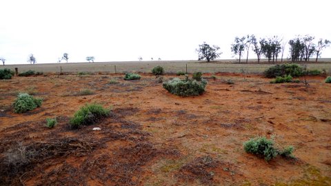
I pull off the road at a rest area 67 km west of Caiguna where I stop for the night.

Saturday 24 April 2010

Leaving NSW, Victoria


I have been asked to do some design work for a fund-raising operation regarding the earthquake in Tibet, so I stayed another 3 days longer in Sydney at the Tibetan community.  I leave early on Wednesday morning threading my motorhome through Sydney traffic in order to get onto the Hume Highway which leads westward, toward Canberra.  Its a 4-lane highway, virtually all the way to Albury with only a few short sections of the old highway.  I have picked such a good day, beautiful and sunny, cumulus clouds all the way, building into something that could turn into a thunder storm.  The countryside is made up of rolling hills, populated by either cattle or sheep, the grass mostly green and there seems to be water in most dams on the properties that roll past me as I head west.  I arrive at Albury around 2pm but head straight to Wodonga, Albury's sister city across the border in Victoria, my aim is to re-stock my German beer supply at Aldi as they are not allowed to sell beer in the state of NSW.
Some of the flat landscape in the Murray Valley

From Wodonga I drive further west for about 15km where I stop by the Murray River in a rest area for the night.  My neighbors are an older couple in a caravan from the Central Coast in NSW and on my other side, a young couple living in a tent with 4 kids.  They are from South Australia and are looking for work in Victoria as they have found it difficult to find work at home.
The following morning I drive west again through Echuca and from there to Kerang.  On my way I encounter a number of Locust 'clouds' smacking into my vehicle as I drive along the highway.  When I stop at Kerang to check into a caravan park, not only my windscreen is covered but also the front part of the Motorhome with a yellow muck from the many dead locusts.  I spend about half an hour to remove the stuff.  I n the morning I continue on to Mildura.  On this leg of the journey I discover what it is really like, having to drive through an onslaught of thousands of locusts.  For about 50km my vision through my windscreen is badly obscured until I finally find a petrol station where I can at least clean my windscreen.  At Mildura I stop at a rest area by a billabong, fetch my bucket and start scrubbing the yellow mess all over the front of the vehicle.  It takes me about 2 hours until its beginning to look clean again.
Billabong outside Mildura

Before and After the cleanup
Its been unseasonally warm with temps in the low 30s - I am really looking forward to a (hopefully) cooler night, which, according to the weather bureau is about to happen, so, with a bit of luck, this may also mean the end of the locusts for tomorrow.

Tuesday 6 April 2010

Mungo Brush, Gloucester


Its about time to catch up!  After having my leg operated on and hanging about in Sydney for 3 weeks, its good to be on the road again, if only for about 2 weeks, as I need to return to the medics for a final check on 14 April in Sydney.
 
To make the best use of the available time I ventured just a little north of Sydney, visiting my friends Cheri and Bryan on Lake Macquarie.  We certainly had to catch up on lots as we had not seen each other for more than a year.  Good friends are usually not in great abundance, a great pleasure indeed to be welcomed with lots of hugs and affection.
 
When I leave the following (late) morning its to drive a little further up the coast, about 100km to a campground called Mungo Brush, located on a peninsula between the ocean and Myall Lake.  A really lovely spot, also with lots of campers as this is the Easter weekend when many families take time off with the kids, getting back to nature, a campfire at night (where permitted) and some simple fun like playing ball games etc.
Sunset at Mungo Brush
Such a relaxed atmosphere.  I spent 3 days there making friends with some of my neighbors.  On Easter Saturday I leave to drive to Forster, yet another holiday destination for Sydney-siders, so I only drive in to re-fill my fridge and top up my watersupply and fuel tank.  It is quite warm and humid at Forster, also, as expected, lots of Easter tourists.  I drive away from the coast to Gloucester, a good 80km and also at a somewhat higher altitude, to escape from the humidity of the coast.  I am also looking forward to a hot shower as I had not had one for the last 3 days in the scrub. 
 
 A great place to stay
 
 Camping at its best
 
The following morning, on Easter sunday, I drive a little north to a campground called Bretti Reserve, a lovely spot I had discovered when I was in this area about a year ago.  It is located at the bottom of a valley, embedded by rolling green hills and 2 rivers that border the reserve on 2 sides of the rectangle.  Quite beautiful.  Lots of tents and a few caravans there for the Easter holiday but really, a quiet spot where I intend to spend some time at.
 
When I leave on Tuesday morning the fog had just cleared from the valley but its overcast and looks like rain is on the way.  I follow the winding road toward the town of Walcha.  My last campsite in the valley was a scant 120m above sea level.  Now I am driving through high country cattle pastures at altitudes between 1100m and 1400m above sea level.  Its raining and at this altitude quite fresh.  I stop at Walcha where I am now posting this post to go on-line as there was no signal over the past few days.